Signed August 3rd, 1795, the Treaty of Greenville followed negotiations after the Native American loss at the Battle of Fallen Timbers in 1794. This defeat ended the ten-year-long Northwest Indian War and established the Greenville Treaty Line, which for many years...
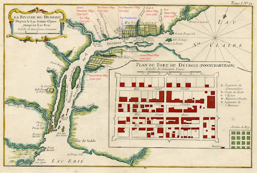
The Detroit Potawatomi left their villages on the Detroit River in October 1763 and spread their villages to the south and west, setting up various hunting camps. In 1765, they established several villages on the Huron River and, at that time, became known as...
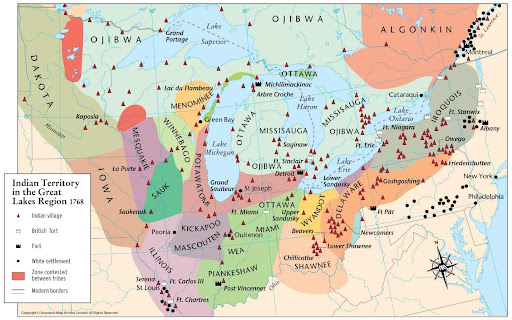
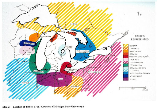
In the 1700s, three groups of Potawatomi were identified based primarily on their locations (Sultzman, 1998, p. 3): The “Detroit Potawatomi” of southeast Michigan The “Prairie Potawatomi” of northern Illinois...
The French and Algonquin* started pushing the Iroquois back to New York in 1687 (“Potawatomi,” 2019, p. 1). As the invaders withdrew, the Potawatomi journeyed south along Lake Michigan, reaching the southern shores around 1695 (“Potawatomi,”...
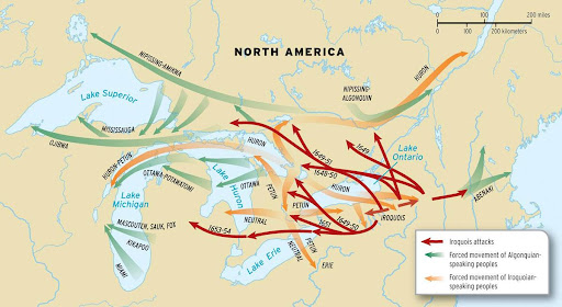
During the mid-seventeenth century, in an attempt to dominate the fur trade as well as the trade between European markets and tribes of the western Great Lakes region, the Iroquois, supplied with Dutch and English firearms, aggressively expanded their territory...
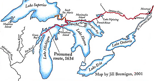
Figure 4. Jean Nicolet’s presumed route through the Great Lakes. Adapted from “Jean Nicolet’s Search for the South Sea,” by N. Risjord, n.d., p. 8, Retrieved from...
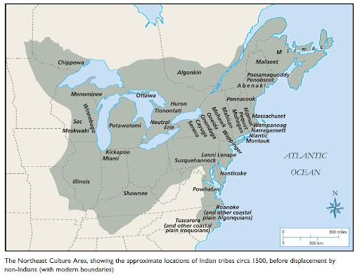
Figure 3. The Northeast Culture Area, showing the approximate locations of Indian tribes circa 1500, before displacement by non-Indians (with modern boundaries). Reprinted from “Northeast Woodlands Culture,” n.d., Retrieved from...
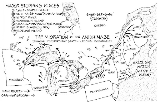
Figure 1. The Migration of the Anishinabe Showing Present-Day State and National Boundaries. Reprinted from”The Migration of the Anishinabe” by E. Benai, 2010, The Mishomis Book: The Voice of the Ojibway, p. 102. The”Council of Three Fire” (in...